Hello, North America! note:sorry to the Pacific Northwest, BC and Alaska. You didn't make the cut. Try again next year.
Via NASA 360

Hello, North America! note:sorry to the Pacific Northwest, BC and Alaska. You didn't make the cut. Try again next year.
Via NASA 360
Pearl Harbor was originally an extensive shallow embayment called Wai Momi (meaning, “pearl water”) or Puʻuloa (meaning, “long hill”) by the Hawaiians. Puʻuloa was regarded as the home of the shark goddess, Kaʻahupahau, and her brother (or son), Kahiʻuka, in Hawaiian legends. According to tradition, Keaunui, the head of the powerful Ewa chiefs, is credited with cutting a navigable channel near the present Puʻuloa saltworks, by which made the estuary, known as “Pearl River,” accessible to navigation. Making due allowance for legendary amplification, the estuary already had an outlet for its waters where the present gap is; but Keaunui is typically given the credit for widening and deepening it. -source wikipedia
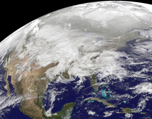
That's one big snow-cone!
As a giant snowstorm plowed across the U.S. this week, the GOES-13 weather satellite drifted 22,000 miles overhead, capturing all the snowy chaos in a single dramatic frame. The resulting image, pictured above, reveals just how big the storm became.
Where's my bottle of bourbon?


This Oct. 12, 2010 photo released by NASA shows a full-disk image of North and South America.


GeoGarage pour la diffusion et la consultation de vos cartographies numériques via l'Internet.
GeoGarage took NOAA charts and overlaid them with mapping server data from Google, Microsoft and Yahoo to demonstrate their technology. Check out the demo, it's pretty damn cool.
Via Craig.
Technorati Tags: online charts, noaa charts online, nautical charts
Sailors live and die by the weather. So it's a good thing when we are given additional resources.
Thanks to NOAA and NASA for a job well done.
Links: Operational Significant Event Imagery | n2yo | stormtrack
Tags: satellite, weather, earth imaging, NOAA, NASA
Powered by Qumana
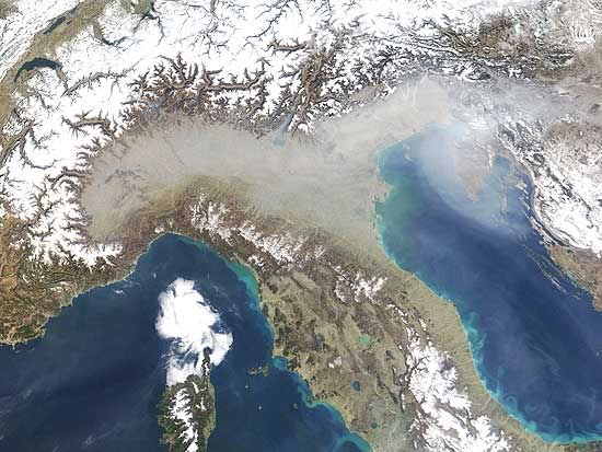
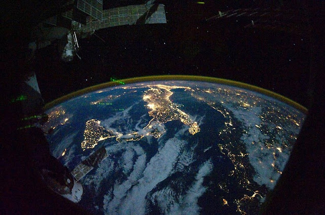
Northern Italy from space.